Budget Annapurna Circuit Trek

Budget Annapurna Circuit Trek

11 Days 5416m Easy
Overview Itinerary Cost Gallery

Facts About Trip

Duration11 days
Max Elevation5,416 m
Nights10 nights
PriceUS$580

Overview And Highlights

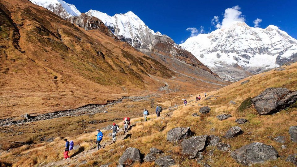
Budget Annapurna Circuit Trek is economic trekking option to trek round the Annapurna Himalayan range. This trekking is low cost package only offers necessary services only the trek. Annapurna Circuit was the top 10 traveling destination for many years in many international travel portals. Annapurna is one of the most visited and pleasant trekking destination among the destinations for trekking in Nepal.

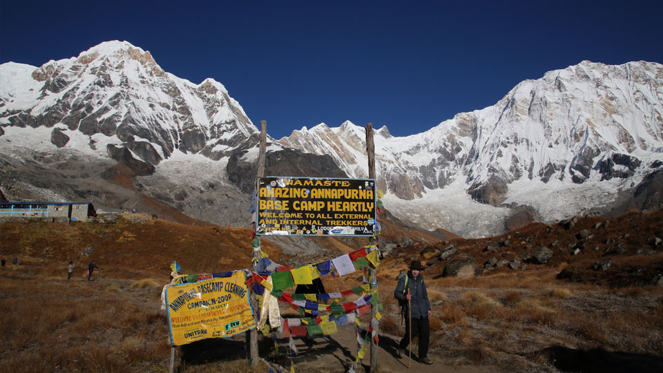
Like in the Annapurna Base Camp Trek, this Annapurna Circuit trek consist manacle of peaks including Annapurna I, Annapurna II, Annapurna III, Dhaulagiri, Manaslu, Machhapuchare (Fishtail), Hiunchuli, Gangapurna, and other hundreds of peaks.

The Annapurna Circuit Trek is taken as the spectacular trekking route in the Annapurna region since it opened to foreign trekkers in 1977. It requires total three weeks to circle round but most of the trekkers shorten the route and fly back to Pokhara from Jomsom. Budget Annapurna Circuit trek starts from Bhulbhule via the Besishahar. It follows along the Marshyangdi River, with great view of Manashlu and Himal Chuli to the east.

The high elevation of the trek is at Thorong La pass (5416m). Usually the trekking is cross in an anti-clockwise direction to make the crossing this pass easy. Trekking in the mid-day is almost difficult to cross the pass. So for the early attempt of crossing pass the trekking is recommended in counter clockwise. It is considered as the difficult trekking part to cross the Thorong La. Trekking route descends from the top of the pass to Muktinath where we spend the night.

Budget Annapurna Circuit Trek is economic trekking option to trek round the Annapurna Himalayan range. This trekking is low cost package only offers necessary services only the trek. Annapurna Circuit was the top 10 traveling destination for many years in many international travel portals. Annapurna is one of the most visited and pleasant trekking destination among the destinations for trekking in Nepal.

Like in the Annapurna Base Camp Trek, this Annapurna Circuit trek consist manacle of peaks including Annapurna I, Annapurna II, Annapurna III, Dhaulagiri, Manaslu, Machhapuchare (Fishtail), Hiunchuli, Gangapurna, and other hundreds of peaks.

The Annapurna Circuit Trek is taken as the spectacular trekking route in the Annapurna region since it opened to foreign trekkers in 1977. It requires total three weeks to circle round but most of the trekkers shorten the route and fly back to Pokhara from Jomsom. Budget Annapurna Circuit trek starts from Bhulbhule via the Besishahar. It follows along the Marshyangdi River, with great view of Manashlu and Himal Chuli to the east.

The high elevation of the trek is at Thorong La pass (5416m). Usually the trekking is cross in an anti-clockwise direction to make the crossing this pass easy. Trekking in the mid-day is almost difficult to cross the pass. So for the early attempt of crossing pass the trekking is recommended in counter clockwise. It is considered as the difficult trekking part to cross the Thorong La. Trekking route descends from the top of the pass to Muktinath where we spend the night.

Day to Day Itinerary

Accommodation

Kathmandu

Walking Duration

20 minutes

Starts From

Arrival

Ends At

Kathmandu

Our team member will be waiting outside the airport terminal a few meters from the exit door. Please check your name at Show card. He will bring you to hotel in Kathmandu. The drive from the airport to the hotel is around 20 minutes. After refreshment, we will brief your plan more visi
Max Elevation

840 m.

Walking Duration

7 hours

Starts From

Kathmandu

Ends At

Besisahara

(7 hours’ drive) Our trekking guide comes to hotel at briefed time. Company vehicle will transfer you to the bus station then take on a public bus from there to Besisahara-bhulbhule. If you take jeep service then same vehicle will take you to Bhulbhule. Overnight at bhulbhule.Along the journey you will witness some spectacular scenery of some white mountains, green hills, rivers and hamlets.
Max Elevation

1400 m.

Walking Duration

6 hours

Starts From

Bhulbhule

Ends At

Jagat

(Trekking: approximately 6 hours) left the road then across the expansion bride in bhulbhule. slipperyup and down trail passAmphitheatre shaped rice terraces through bahundada, thamigaon. Somewhere in thamigaon can have lunch break too. Descend till syange then trail will lead ascend till teashop then walk flat and descend to the Jagat. As we near the village of Jagat we will have a trail that has been blasted out of the rock face. 15 minutes below this village we can visit another small hot spring.Overnight at Jagat.
Max Elevation

1960 m.

Walking Duration

6 hours

Starts From

Jagat

Ends At

Dharapani

(Trekking: approximately 6 hours) We start the day by descending flat on a road. We will see a few waterfalls as well too. After chamje need to cross the bridge then ascend, descend & ascend slowly till Tal. We will pass the village of Tal at 1700 meter which lies at the foot of a large waterfall.Where we might have a lunch too. The trail crosses a broad, flat valley that was once a lake (Tal means lake) after which we will cross the Marsyangdi by a 60 meter long suspension bridge. The trail will climb up from a second suspension bridge to a stone kani (an arch over the trail) which marks the entrance to Dharapani at 1960 meter.
Max Elevation

2620 m.

Walking Duration

7 hours

Starts From

Dharapani

Ends At

Chame

(Trekking: approximately 7 hours) Today we will do some ascent in total. to Bagarchap through bamboo and rhododendron forests, on a trail high above the river bank. The trail slowly climbs from here on through a forest of blue pine, spruce, hemlock, maple and oak tillBagarchhap, danaque, timangBesi, Thanchok and chame. Bagarchhap is the first village on the trek with typical Tibetan architecture. Closely spaced stone houses, with flat roofs piled high with firewood.
Max Elevation

3190 m.

Walking Duration

5 hours

Starts From

Chame

Ends At

Pisang

(Trekking: approximately 5 hours) We will first pass the older part of Chame and climb up to Telekhu at 2840 meter and continue with a long pleasant and mostly level walk through the forest to Brathang, which lies at 2950 meter. After the trail rounds a bend here we will see the first view of the dramatic Paungda Danda rock face, a tremendous curved slab of rock rising more than 1500 meter from the river. We will cross back to the south bank of the Marsyangdi on a suspension bridge at 3080 meter altitude. And then make a long gentle climb over a ridge through blue pine forests. After this the trek will be reasonably level as it heads to the upper part of Manang valley to Pisang. This town marks the beginning of the region known as Nyesyang, the upper portion of the Manang district.Pisang has a upper and lower village. Upper has good view then lower, lower has good lodges then upper.
Max Elevation

3540 m.

Walking Duration

5 hours

Starts From

Pisang

Ends At

Manang

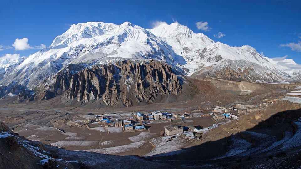
(Trekking: approximately 5 hours) Today our trek will slowly climb up to the Tibetan-style village of Braga at 3500 meter following the valley floor. At Braga we will see houses stacked one atop the other, each with an open veranda formed by a neighbor’s rooftop. The gompa(monastery) perched on a high crag overlooking the village, is the largest in the district and has an outstanding display of statues. We then continue through a very arid countryside, dominated by weird cliffs of yellow rock, eroded into dramatic pillars alongside the trail to reach today’s destination, the village of Manang, where the shops are surprisingly well stocked with all the things you might want to refuel on.
Today we stay in Manang where we can do a short hike to ascent slightly higher to for instance Gangapurna Glacier, cave monastery, ice lake, which is a ascend then descend to the Manang again. It is important to have a relatively restful day today, to allow your body to acclimatize to the higher altitudes and thinning air. It also gives us the possibility to wash some of our clothing.
Max Elevation

4200 m.

Walking Duration

30 hours

Starts From

Manang

Ends At

Yak Kharka

(Trekking: approximately 4:30 hours) Trekking slowly upwards to Thorung La we will leave the large trees behind and see vegetation consisting mainly of scrub juniper and alpine grass and we will pass a few meadows where horses and yaks graze. After we reach Yak Kharka we will see herds of blue sheep grazing the steep slopes as well. About an hour after passing Yak Kharka we will arrive at Letdar.
Max Elevation

4440 m.

Walking Duration

30 hours

Starts From

Letdar

Ends At

ThorangPhedi

(Trekking: approximately 3:30 hours) Again a relatively easy day to get used to the altitude before we have to cross the highest point in the trek, and possibly the highest point you have been on in your life. From Letdar we will continue to climb along the east bank of the Jarang Khola to ThorungPhedi, a rock-strewn meadow surrounded by vertical cliffs at 4420 meter. Blue sheep and even snow leopards can be sometimes seen in this valley. High in the skies above us we can see lammergeyer and Himalayan griffons circling around.
Max Elevation

5416 m.

Walking Duration

10 hours

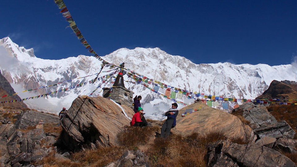
(Trekking: approximately 10 hours) Today is a long trek starting before sunrise at maybe 04:00 o’clock to reach the pass by 09:00/10:00 hours at the latest, as otherwise weather conditions will greatly affect the journey. We cross over at an altitude of 5416 m so can be exposed to strong winds if crossing to late. Local people have used this trail for hundreds of years to bring herds of sheep and yaks in and out of Manang Thus the trail, while often steep, is well defined and easy to follow. Snow can block the pass at any time of the year if there has been an unseasonable storm. It takes from four to six hours from ThorungPhedi to the pass, but the many false summits mean the climb seems to go on forever. At the Thorung La pass, with its traditional prayer flags and stone cairn we will have outstanding views. You can see the Annapurna, Gangapurna and KhatungKang, Tarke Kang, thorang la peak, etc. Amazingly there is a teashop here on top of the pass at 5416 meter. From here we start a long descend of about 1600 meter with outstanding views of Dhaulagiri, Nilgiri, Tilicho etc. mountain standing alone in the distance across the valley. After the trail becomes less steep we will enter grassy fields and cross meadows to our final destination of Muktinath, which means place of Nirvana and is home of the gods, as well as local people and several monasteries. It is said that all sorrows you feel are relieved when visiting the Temple, which is a scared pilgrimage site to both Hindus and Buddhists. The main pilgrimage normally takes place in September. The Temple is dedicated to Lord Vishnu and has 108 waterspouts around it from which Holy water pours. Another attraction nearby is the Jwala Mai Temple and this contains a spring and an eternal flame fed by natural underground.
Walking Duration

6 hours

Starts From

Muktinath

Ends At

Marpha

(Trekking: approximately 6 hours) From today we will follow the “Jomsom trek” in reverse order. We will first go down to Kagbeni, which is a 990 meter descend through meadows, streams and fruit trees like peach orchards of apples. Then we will continue going down to Jomson (more correctly Dzongsam, or “new fort”). Our descend continues through the Kali Gandaki Valley to Marpha. Marpha is home to many apple orchids as well as all the various food products made from the fruit. Apple Brandy is a local specialty that you may be lucky enough to taste en route.
Max Elevation

2530 m.

Walking Duration

6 hours

Starts From

Marpha

Ends At

Ghasa

(Trekking: approximately 6 hours) This day will be a rewarding day when we trek further down the Kali Gandaki valley alongside the Kali Gandaki river to Ghasa. We will pass the villages of Tukuche at 2580 meter and Larjung at 2560 meter. We then cross the the Kali Gandaki river by a high suspension bridge and continue through an area covered with fir, juniper and cypress trees. Towards the village of Kalopani (2530m) we will have splendid 360˚ views of Dhaulagiri, Tukuche Peak, the three Nilgiris, Fang and Annapurna I. After crossing another very long suspension bridge (107 meter long) we will reach Ghasa, our base for this night.
Max Elevation

1450 m.

Walking Duration

5 hours

Starts From

Ghasa

Ends At

Tatopani

(Trekking: approximately 5 hours) Today our trek leads us through the steepest and narrowest part of the Kali Gandaki valley; much of the way is cut through solid rock and subject to frequent landslides. Before we reach the village of Dana (1450 m) we pass the RupseChhahara (‘beautiful waterfall’). Descending further down past several landslides we will reach Tatopani, meaning hot water, which is situated on the riverbanks where we will stop to make the most of a well deserved hot bath.
Max Elevation

2834 m.

Walking Duration

7 hours

Starts From

Tatopani

Ends At

Ghorepani

(Trekking: approximately 7 hours) Leaving the hot springs behind us we have a day of climbing ahead of us to Ghorepani. We leave the Kali Gandaki valley and we will follow the GharKholariver and cross this river on an old swaying bridge. We will continue ascending to Ghara (1780 m) and Shika (1935 m) where there still is a British army training centre. The last part of the trail today will have us climbing through rhododendron and magnolia forests to Ghorepani.
Max Elevation

3210 m.

Walking Duration

6 hours

Starts From

Ghorepani

Ends At

Pokhara via Poon Hill

(Trekking: approximately 6 hours) An early start and an hour’s hiking to Poon Hill (3210 m) leads us to a brilliant spectacle, this viewpoint provides an unobstructed beautiful sunrise over the high Himalayas. After spending about few minutes on the hillside, we come back to Ghorepani for a hot breakfast, and start walking to Tikhedhunga(1550 m). From Ghorepani the trails descend through pine, rhododendron forests and villages. Gently descend to the destination Nayapul through small villages. After rich Nayapul can get vehicle to go Pokhara.
Walking Duration

5-6 hours

Starts From

Return back

Ends At

Kathmandu by tourist bus

The bus journey will take 5 to 6 hours, free rest of day in Kathmandu and shopping
Transfer you to TIA airport then Tour ends.

Services Included on Price

Selected packageRegular PackageIncludes the services listed below for this package type.
USD 580per person
Book Trip

Regular Package Service Includes

  • Airport Pick and Drop via Private Transport
  • 2 night stay at the hotel in Kathmandu including breakfast with twin sharing basic.
  • One night stay at the hotel in Pokhara including breakfast with twin sharing basic.
  • All government taxes and Annapurna conservation entry fees.
  • Kathmandu to Besisahar via local transport
  • Pokhara to Kathmandu via Tourist Bus
  • Nayapul to Pokhara via Local Bus
  • TIMS CARD (Trekking Information Management System).
  • Required number of experienced English speaking guides and support staff (we pay for their daily wages, insurances, trekking equipment, food and accommodation).
  • 16 days porter wages and his insurances/meals/accommodation/equipment
  • 16 days guide wages and his insurances/meals/accommodation/equipment
  • Rescue arrangement in emergency situation & worst weather condition
  • 14 nights Lodge accommodation during the trek on tea house services.
  • Necessary ground transportation depending upon your request (via tourist bus or private vehicle).
  • Trekking Ending Point to Pokhara
  • Trekking poles, sleeping bag/duffle bag (we provide these if necessary).
  • Trekking maps.
  • Rubbish disposal.
  • Our service charge and government taxes.

Regular Package Service Excludes

  • All meals in Kathmandu and during trekking
  • Extra Hotel stay in Kathmandu.
  • Tips to guides and support staff.
  • Additional costs in case of emergency (You must have adequate travel insurance to cover any kind of emergencies, such as ground transportation & Heli recue/medical/hospitalization. Medical etc).
  • Your International flight ticket airfare
  • Energetic chocolate/energy drinks/alcohol/mineral water/cigarettes/packing food snacks etc
  • Additional medication for altitude sickness (Acetazolamide etc).
  • Personal expenses and any other unforeseen expenses, such as Laundry/WIFI on trek/phone call
  • Personal trekking equipment.
  • Nepal entry visa fees which can get up on your arrival in Kathmandu airport
  • Sightseeing tour and All the entrance fees of temple in Kathmandu
  • Services not mentioned herein

Altitude Graph

Client Reviews

No reviews yet. Traveled with us on this trip? Be the first to share your experience.

Book Now Inquiry
You May Also Like

Similar Packages

Enjoy popular trekking and tour packages in the Nepal Himalayas.
Annapurna Base Camp Trek Annapurna Region Trekking Easy
Annapurna Base Camp Trek
DurationFlexible
Max Altitude
DifficultyEasy
ActivityTrekking in Nepal
Short Annapurna Base Camp Trek Annapurna Region Trekking Easy From $500
Short Annapurna Base Camp Trek
Duration7 Days
Max Altitude4130m
DifficultyEasy
ActivityTrekking in Nepal
Budget Annapurna Base Camp Trek Annapurna Region Trekking Easy
Budget Annapurna Base Camp Trek
DurationFlexible
Max Altitude
DifficultyEasy
ActivityTrekking in Nepal
Annapurna Base Camp Trekking Annapurna Region Trekking Easy From $525
Annapurna Base Camp Trekking
Duration7 Days
Max Altitude4130m
DifficultyEasy
ActivityTrekking in Nepal
Annapurna Circuit Trekking Annapurna Region Trekking Easy From $715
Annapurna Circuit Trekking
Duration18 Days
Max Altitude5416m
DifficultyEasy
ActivityTrekking in Nepal
Ghorepani Ghandruk Trek Annapurna Region Trekking Easy
Ghorepani Ghandruk Trek
DurationFlexible
Max Altitude
DifficultyEasy
ActivityTrekking in Nepal