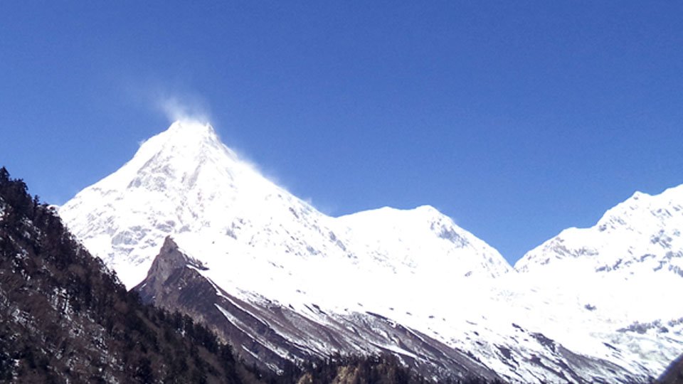
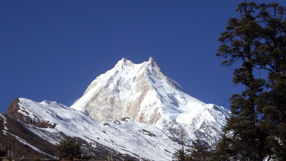
Manaslu Trek – 18 Days is more or less regarded as a remote and pristine trek with remarkable views of Mount Manaslu; placed east of the Annapurna Himalayan range. The name Manaslu refers as “The Spirit of Mountain” According to the local language, it refers to be the substantial and strong divinity that dwells within. Manaslu Trek – 18 Days coarsely circles the world’s eighth highest mountain Manaslu (8,163 m); thus, becoming popular trekking trail for the travelers as other famous trekking trails like Everest, Annapurna, Langtang and so on. The Nepalese Government make the Trekking to Manaslu official in 1992, hence, has been open to organized trekking parties only.
Manaslu Larke (Larkye) La Pass (5,106 m) is a stimulating and steep pass and Manaslu Trek among the most chosen trekking destinations. Trekkers can hear some special dialects, as it is near the border of Nepal and Tibet. The remote trail of Manaslu Trek – 18 Days offer the perfect combination of rich cultural heritage and outstanding Himalayan beauty. Furthermore, the trail passes through the subtropical slopes of the Himalaya to the thirsty high Himalayan and to meadows bordering Tibet. Relatively few trekkers take this trek that is why; the environment is serene and still pristine with a true natural flavor. So if you love nature and also desire an easy and incredible trekking, this is definitely worth your time.
As Manaslu Trek is quite diverse to other regions, as it is anticipated that this trekking trail will be one of the most popular trekking trails very soon. According to the recent analysis of 2012, it has shown that the largest number of tourists made their trip to this region. This route of Manaslu Trekking – 18 Days is getting its fame for its array of scenery, cultural diversity, and it fledging lodges. Trekker with ample time can also include Tsum valley area with fewer trekkers, it has endured unabridged and unchanged for centuries.
Manaslu Trek is a moderate level trek and can be completed by all the avid trekkers throughout the world. This trek offers your lifetime unforgettable memories and makes your holiday awesome. Spring and autumn are the best seasons for Manaslu Circuit trekking/ Manaslu Trek. In these seasons, you can explore the pristine natural beauties and cultural heritages.
| Day | Program | Elevation |
|---|---|---|
| 1 | Arrival and transfer to hotel in Kathmandu Upon arrival in Kathmandu. | 1440m |
| 2 | Kathmandu | 1360m |
| 3 | Kathmandu – Arughat – Soti Khola : 135km, 8-9 hrs drive | 670m-710m |
| 4 | Soti Khola – Machha Khola : ~14km, 6-7 hrs | 890m |
| 5 | Machha Khola – Dobhan : ~11km, 6-7 hrs | 1000m |
| 6 | Dobhan – Philim : ~10km, 6-7 hrs | 1590m |
| 7 | Philim – Lokpa – Chumling :~10km, 6-7 hrs | 2240m-2360m |
| 8 | Deng – Namrung : ~12km, 6-7 hrs. | 2660m |
| 9 | Namrung – Lho : ~4km, 3-4hrs | 3180m |
| 10 | Lho – Sama Gaon : ~8km, 5-6 hrs | 3530m |
| 11 | Sama – Samdo : ~8km, 3-4 hrs | 3860m |
| 12 | Sama – Samdo : ~8km, 3-4 hrs | 3860m |
| 13 | Samdo – Larkya Phedi/Dharamsala : ~7km, 3-5 hrs | 4460m |
| 14 | Dharamsala – Larkya La – Bimthang : ~12km, 7-9 hrs | 5160m-3720m |
| 15 | Bimthang – Gho ~12km, 5-6 hrs | 2515m-8250m |
| 16 | Gho – Dharapani :~8km, 3-4 hrs | 1920m |
| 17 | Dharapani- Besi Sahar (760m/2,495ft) – Kathmandu : ~ 190km 7-8hrs | 760m-1300m |
| 18 | Final departure |
1 photo

No reviews yet. Traveled with us on this trip? Be the first to share your experience.
Enjoy the popular trekking and tour packages in Nepal Himalayas. 2026.
Manaslu & Tsum Valley Trekking is very famous trekking in Nepal. Tsum valley is in restricted area of Nepal and trekking to Tsum Valley is opened
View Details
Manaslu Circuit trek is one of the popular trekking package with excellent mountain views. Trekking to Manaslu in teahouse/camping
View Details
Tsum Valley Trekking is less crowded wilderness trek in the northern Nepal. Trekking in Tsum valley offer great mountain views. Contact now
View Details
Budget Manaslu Circuit Trek is low budget trekking package in Manaslu region. Manaslu Circuit trekking in low budget cost. Contact us now
View Details